Private Access
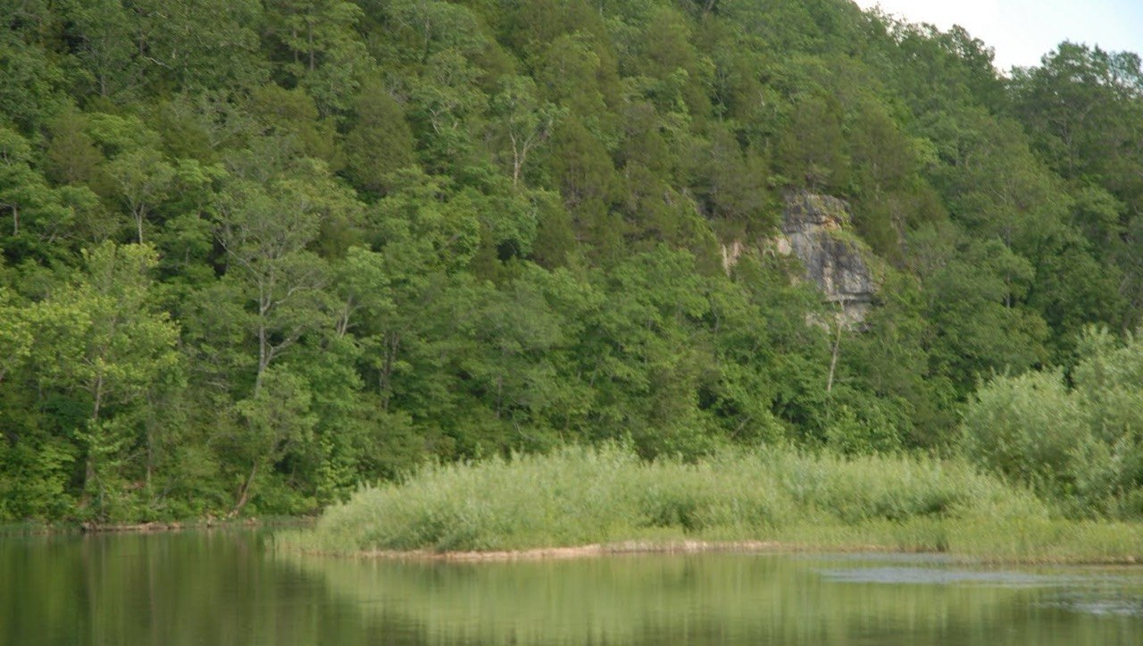
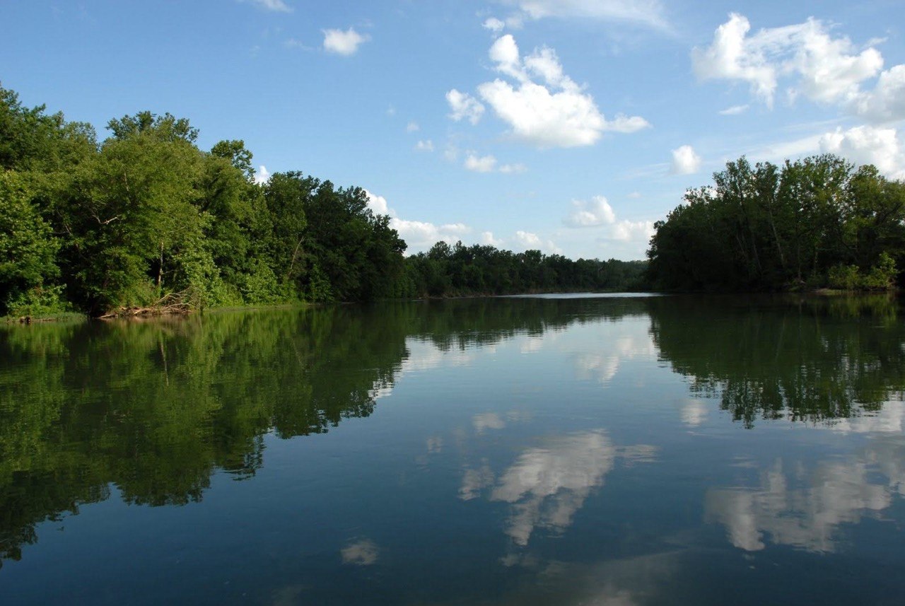
700' +/- of Current River frontage with private boat ramp — controlled launch access on a spring-fed corridor.
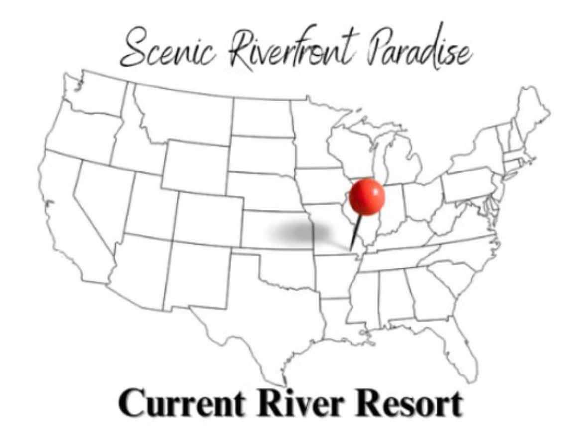
Float Map Guide | Estate For Sale
The Current River has documented float routes with NPS-managed access points for every skill level. This page covers put-in locations, segment distances, seasonal timing, and a private estate for sale with its own launch ramp that eliminates the need for public access coordination entirely.
Current River Estate For Sale | 20 acres +/- | 700' +/- Current River frontage | several hundred feet of County Road U-5 frontage | 4 homes | 15+ acres vacant land
20 acres +/- | 700' +/- Current River frontage | several hundred feet of County Road U-5 frontage | 4 homes | 15+ acres vacant land
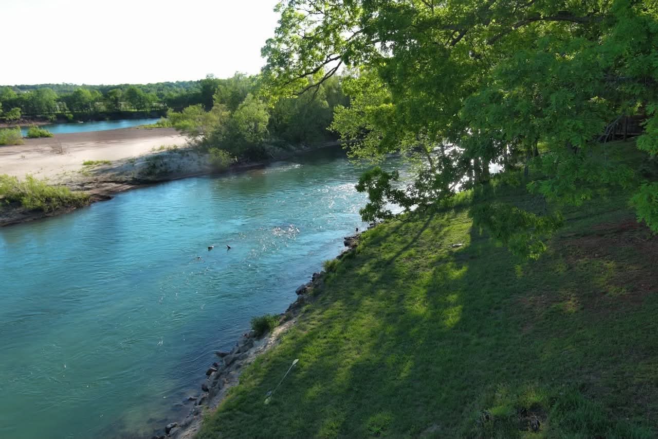
700' +/- of Current River frontage with private boat ramp — controlled launch access on a spring-fed corridor.
Several hundred feet of County Road U-5 frontage provides reliable vehicle access and long-term operational practicality.
15+ acres between frontages preserve privacy and maintain future development flexibility within the estate's footprint.
Four residences and a private boat ramp make the estate immediately usable for family, guests, and organized recreational use.
Every Current River float starts with a logistics problem: where do you put in, where does the shuttle wait, how far are you floating, and what happens if you want to stop earlier? Public access requires planning every one of those variables in advance.
The NPS publishes official float segment distances and access point maps for the Current River. Segments range from 5 to 25+ miles between public put-in and take-out points. Private launch eliminates both endpoints — you start and end on your own property.
Optimal float conditions on the Current River occur when flow rates sit between 200-800 cfs. Spring-fed stability means those conditions hold from early spring through late fall — with USGS real-time data accessible for pre-trip verification.
Public put-in points require shuttles, parking, and coordination with outfitters or second vehicles. Private launch access eliminates the logistics and allows same-day, spontaneous river use without pre-planning.
This estate eliminates the problem. Private launch ramp. 700' of frontage. Come and go on your own schedule. No shuttle, no outfitter coordination, no crowded put-in. Four homes for whoever comes with you. That's the private access version of everything the float map represents.
The NPS float map shows where you can start and stop on public access. A private ramp on 700' of estate frontage adds a third option — one that's available every day without coordinating with anyone else's schedule.
Frequent floaters eventually realize that outfitter logistics are the limiting factor. Private infrastructure removes that limit.
Float trips are inherently group activities. Organizing groups at public put-in points means coordinating multiple vehicles, strangers, and shared facilities. The estate's private ramp and four-home layout gives trip organizers private infrastructure for the whole experience.
The estate supports both day floats and multi-day trip staging from a single location.
The NPS float map is an excellent planning tool for occasional visitors. For regular Current River users, the map eventually becomes a constraint — you can only start where they say and end where they say. Private launch access removes those constraints entirely.
The estate's private boat ramp on 700' of Current River frontage means the float map becomes a reference, not a requirement. You plan around your schedule and your float preferences — not around outfitter availability or public lot competition.
20 acres +/- | 700' +/- Current River frontage | several hundred feet of County Road U-5 frontage | 4 homes | 15+ acres vacant land
Spring-fed, spring-clear, and federally protected.
Private access changes everything about this corridor.
The Current River's most popular public access points include Montauk State Park, Akers Ferry, Two Rivers, Round Spring, Pulltite, and Big Spring. Experienced floaters use these as reference points for trip length and river character. Private access on this estate is positioned within this documented corridor.
The Current River is generally Class I-II, appropriate for canoes, kayaks, and inflatable crafts. Spring-fed flow consistency keeps conditions predictable for most of the year. Real-time USGS stream gauge data is available for pre-trip flow confirmation.
Multiple outfitters operate on the Current River, providing canoe and kayak rentals, shuttles, and camping gear. Their presence supports casual visitors. Private ownership eliminates the need for their services — and the dependence on their availability.
Private launch access means deciding to float at 7am and being on the water by 7:15. No reservation. No shuttle wait. No parking coordination. The estate's infrastructure makes the Current River as spontaneous as a walk to your backyard — because the ramp is in your backyard.
Government and institutional sources for planning, research, and ownership due diligence in the Current River corridor.
Official NPS float trip planning resources including segment distances, access point maps, difficulty ratings, and seasonal advisories for the Current River. View Official Resource.
Real-time and historical flow data for the Current River from USGS stream gauges — essential for pre-float planning and water level assessment. View Official Resource.
Official park map showing access points, campgrounds, float routes, and land boundaries for the Ozark National Scenic Riverways. View Official Resource.
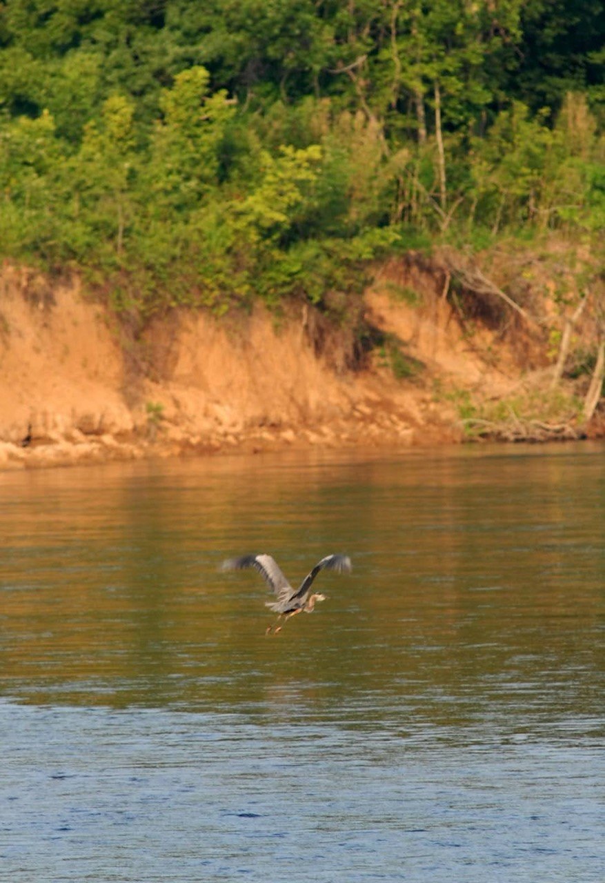
Water, wildlife, and private access — the visual case for owning on the Current River.

The estate's private boat ramp provides direct access to the Current River's documented float corridor. From the estate, floaters can access multiple public take-out points downstream, or return to the private ramp as a take-out point for shorter circuits. The NPS float map shows access infrastructure throughout the surrounding corridor for planning multi-day trips.
Yes. The Current River is primarily Class I-II, making it appropriate for canoes, kayaks, and family rafts. The spring-fed temperature keeps the water cold but consistently clear. The NPS recommends standard PFD use and provides safety guidelines for all float segments. Private launch access from the estate allows families to self-stage trips at their own pace.
Request a showing and see what private launch access on the Current River actually looks like.
Buyers who float the Current River regularly understand the logistics friction of public access. A showing lets you see the private ramp, evaluate the frontage, and have a direct conversation about what full ownership of this infrastructure looks like.

Pricing and terms, survey and title documentation, private tour scheduling, ownership structure, permitted use context, and long-term positioning within the Current River corridor.
The float map shows you where the public can launch. This estate shows you where you can launch privately — any time, any day.